Rehabilitate Eastern Approach of NYS Capitol Building
MFS (formerly GEOD) provided comprehensive 3-D laser scanning and subsurface utility mark out services to support the rehabilitation project of the eastern side of the NYS Capitol Building in Albany, NY. The project encompassed the restoration of the Eastern Approach Staircase, Promenades, Eastern Portico, and Executive Ramp.
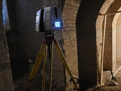
Field technicians meticulously established survey and secondary scan control for each scan setup. Scans were systematically obtained at all designated locations, covering the entirety of the eastern approach staircase, promenades, eastern portico, and executive ramp. Point cloud data was meticulously processed, registered to the project control, and exported as rcp, e57, and xyz file formats.
MFS (formerly GEOD) conducted a comprehensive subsurface utility investigation utilizing state-of-the-art equipment and methodologies. A combination of electromagnetic (EM) locators and ground penetrating radar (GPR) was employed to accurately map out subsurface utilities within the project area. All identified utilities were meticulously marked using paint and/or pin flags to ensure their visibility and preservation during the rehabilitation process.
Through its expertise in 3-D laser scanning and subsurface utility investigation, MFS successfully contributed to the rehabilitation efforts of the Eastern Approach of the NYS Capitol Building in Albany, NY. The comprehensive data and insights provided by MFS will play a crucial role in ensuring the seamless and efficient execution of the rehabilitation project while upholding the highest standards of accuracy, efficiency, and safety.

- Owner: NYSOGS
- Services: 3D Laser Scanning
- Services: Surface Utility Markouts
